If you’re looking for a nice walk, we’ve got just the route for you.
Take Gully Hill Road (off Loudon Road) to find the kiosk for the Merrimack River Greenway Trail. It’s just behind the parking lot for Buffalo Wild Wings. And if you don’t mind, pick us up some wings while you’re there. We like the boneless kind with mild buffalo sauce.
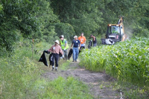
From the kiosk, you’ll see this wide dirt path to the right. It’s a little muddy and watery in spots after all the snow finally melted away, but you’ll see it. The trail lies between the corn fields and the tree lined Merrimack River.
Once the water and mud go away, the path will take you further away from Loudon Road and deeper into nature. But for those city folks out there, don’t worry – you can still see the golden dome that sits atop the State House. Once you reach the row of pines and travel a little more, you’ll come to some wetlands, where you can see Terrill Park.
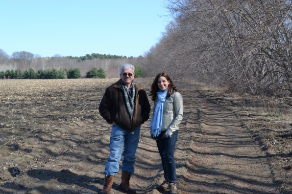
“This is a great community resource,” said Dick Lemieux, the president and chair of trustees for the Friends of the Merrimack River Greenway Trail. “We’re doing this for the residents of the city and for the visitors of the city.”
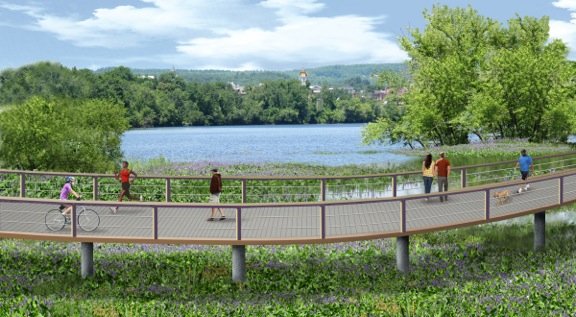
And hopefully by the end of next year, there will be a way to cross over the wetlands and get to Terrill Park. That’s because the Friends of the Merrimack River Greenway Trail are currently working through the design phase of a boardwalk that will be 1,500-feet long and 12-feet wide. When it’s completed, the boardwalk and two sections of 10-to-12 foot-wide paved trails will be the final piece to creating a three-mile loop connecting downtown to the dirt area you’re currently in (or imagining you’re in.)
“You’ll be able to see the boardwalk from the Manchester Street bridge,” said Stacey Brown, also a trustee with the Friends of the Merrimack River Greenway Trail.
The earliest reference to a project of this kind dates back to 1990, but nothing came of it until a 2010 feasibility study determined it was possible. The real push began over the last two years.
“We started fundraising in earnest last year,” said Lemieux.
The design has been broken into two phases, preliminary and final. With about $115,000 raised so far, they’re closing in on the funding needed to get through the final design. The soil will be tested in the next few weeks.
Once the designs are done, the real work can begin. It will cost roughly $1.3 million for the project. In a perfect world, the construction would be done mostly through volunteer help and in-kind donations to reduce costs. But they will also need any of the extra money you have lying around your house.
“It’s going to depend on the design and what it says,” said Brown of the final costs.
But there’s a lot to be done before the first footing is set or section of pavement rolled out. Of course, there’s the money side of it. This project will not get done without grants and donations. There’s an extensive permitting process, especially with the boardwalk going above wetlands and the paved portions of the trail being within a stone’s throw of the Merrimack River.
“Our goal is to have the design completed and have the money for it so we can hand it to the city to build,” said Brown. “Right now we’re just figuring out where the boardwalk will actually be.”
The city has been on board and involved with the project for some time.
It’s just one of those things that will take time to complete, but will be more than worth it when all is said and done. Like the kind of feeling when you eat that first slice of a homemade apple pie. Don’t forget the ice cream.
“We’d like to get the boardwalk built first to get people out here,” said Lemieux. “Everything we want to do is to reconnect people with the river.”
The completion of the boardwalk and paved trails are just a piece of a bigger puzzle. The Merrimack River Greenway Trail is the middle section, a 12-to-14 mile stretch running from Boscawen to Pembroke, that will connect the Northern Rail Trail and a proposed southern section stretching all the way to Salem. Once done, it will be part of a 114-mile trail system, called the Granite State Rail Trail, from Lebanon to Salem. Now that would be one long walk. Might want to etch out a couple days of vacation for that.
But you don’t have to wait for the boardwalk to be built and paths to be paved. You can go out there at any time, although you might want to wait until the water and mud go away or just wear waders. It’s up to you
.
“People don’t realize they can come out here now,” said Brown.
For more info, visit mrgt.org or email info@mrgt.org. There’s also the group’s Facebook page, facebook.com/mrgtfriends.


